Discovery of the Adelaide River
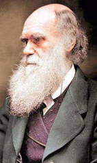
Some of the most important names in Australian exploration are associated with the discovery of the Adelaide River and the world's most famous ship of science, HMS Beagle, which had carried Charles Darwin on a five year journey around the world in search of the origin of species.
Many of the crew from that voyage (Wickham, Stokes, Fitzmaurice & Forsyth) were still with the Beagle for the Third Voyage which furnished Admiralty Charts of much of the Australian coast and discoveries including Port Darwin - the Fitzroy, Adelaide, Victoria and Fitzmaurice Rivers and the charting of Bass Strait, the north coast of Tasmania and the southern coast of Victoria together with the entrance and significant areas of Port Phillip Bay.
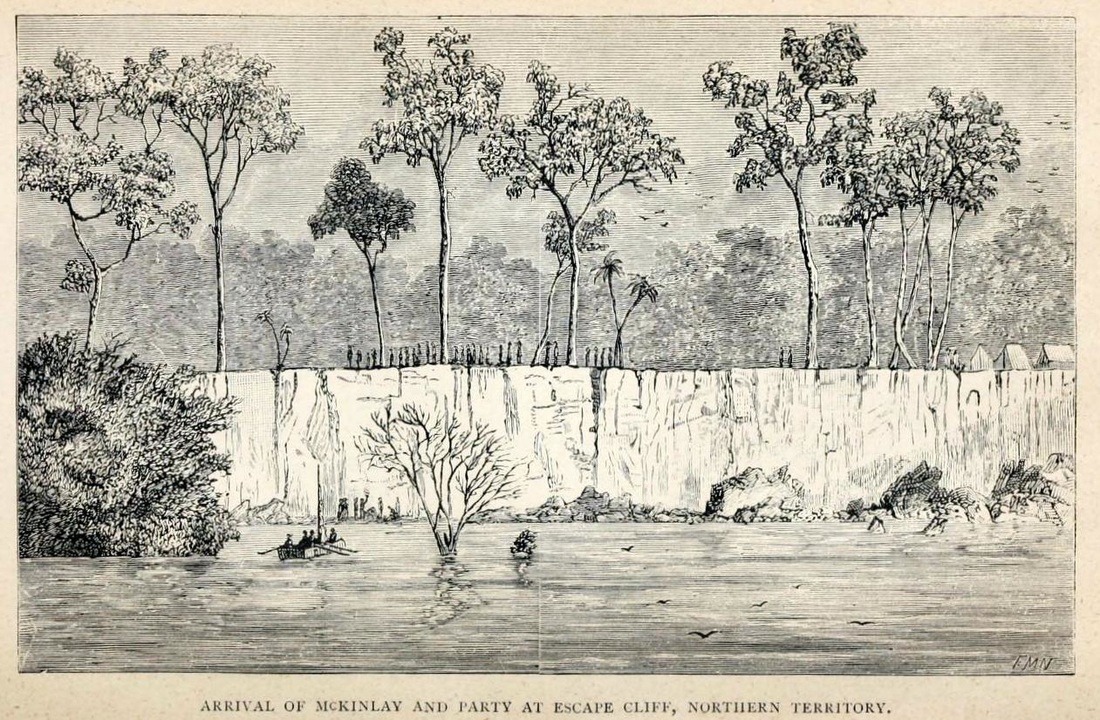
Darwin had been with the Beagle surveying southern Australia but was no longer among the ship's company when, on 27th July 1839, Commander Wickham anchored her in a broad bay off Clarence Strait - dispersing his men to search for a great river to carry exploration into the dark interior which would not be crossed until John McDouall Stuart reached the north coast on 24th July 1862.
Many of the crew from that voyage (Wickham, Stokes, Fitzmaurice & Forsyth) were still with the Beagle for the Third Voyage which furnished Admiralty Charts of much of the Australian coast and discoveries including Port Darwin - the Fitzroy, Adelaide, Victoria and Fitzmaurice Rivers and the charting of Bass Strait, the north coast of Tasmania and the southern coast of Victoria together with the entrance and significant areas of Port Phillip Bay.
Darwin had been with the Beagle surveying southern Australia but was no longer among the ship's company when, on 27th July 1839, Commander Wickham anchored her in a broad bay off Clarence Strait - dispersing his men to search for a great river to carry exploration into the dark interior which would not be crossed until John McDouall Stuart reached the north coast on 24th July 1862.
"Impatient to learn the truth, Mr. Fitzmaurice was despatched to examine the head of the bay, whilst the ship was moved towards it, anchoring again one mile North-West from a very remarkable patch of low red cliffs (which from startling circumstances, hereafter to be related, were called Escape Cliffs)……On returning to the ship we found that Mr. Fitzmaurice had arrived, bringing the expected, and very gratifying intelligence, that a large river with two branches, running South-East and South, with a depth of four fathoms, emptied itself into the head of the bay."
They had discovered the Adelaide River which they named for the Queen Dowager and Adam Bay for Vice-Admiral Sir Charles Adam. It was to become the site of South Australia’s first attempt at a Northern Capital for its Northern Territory and would be called Palmerston - the original name for Darwin City & today the name of her satellite city. Sagas of triumph & disaster - not without their lighter moments.
They had discovered the Adelaide River which they named for the Queen Dowager and Adam Bay for Vice-Admiral Sir Charles Adam. It was to become the site of South Australia’s first attempt at a Northern Capital for its Northern Territory and would be called Palmerston - the original name for Darwin City & today the name of her satellite city. Sagas of triumph & disaster - not without their lighter moments.
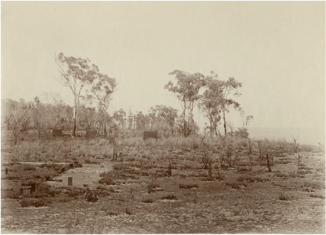
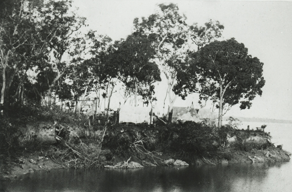
SLSA B-72713-2 'Escape Cliffs, NT looking south' 1899-1918
|
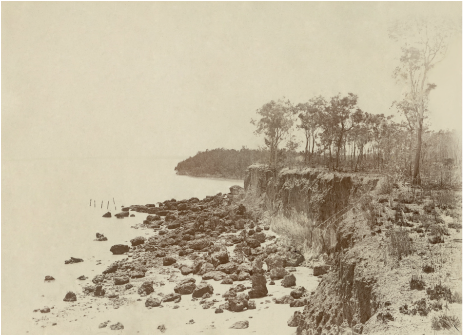
SLSA B-72713-5 'Escape Cliffs NT looking north east'
|
"An exploring party, however, was at once formed, consisting of Captain Wickham, Lieutenant Emery, and Mr. Helpman, who - the next day being Sunday - did not leave before the morning of the 29th, with two boats and four days' provisions". They were to voyage more than 100kms up river past Goat Island and on through the 'S' bends to the extent of dry season navigation below where the Marraki Road now crosses the stream.
Meanwhile Lieutenant Stokes went ashore: - 'Near Escape Cliffs I met a small family of natives, consisting of an elderly man, his wife, and four children; by degrees, advancing alone, I contrived to get near enough to make the woman a present of a handkerchief, in return for which she gave me a large leaf of the cabbage palm, that was slung across he back. I at length drew all the family around me, the eldest child, a youth of about 15, being the most timid. He had a small piece of wood two feet long, sticking through the cartilage of his nose. His teeth & those of the other children were quite perfect, but in the father & mother two of the upper front ones were gone, as we before noticed was the case with the natives at Port Essington, where this ceremony is performed after marriage.'
Meanwhile Lieutenant Stokes went ashore: - 'Near Escape Cliffs I met a small family of natives, consisting of an elderly man, his wife, and four children; by degrees, advancing alone, I contrived to get near enough to make the woman a present of a handkerchief, in return for which she gave me a large leaf of the cabbage palm, that was slung across he back. I at length drew all the family around me, the eldest child, a youth of about 15, being the most timid. He had a small piece of wood two feet long, sticking through the cartilage of his nose. His teeth & those of the other children were quite perfect, but in the father & mother two of the upper front ones were gone, as we before noticed was the case with the natives at Port Essington, where this ceremony is performed after marriage.'
A few days after my interview with the natives, 'Mr. Fitzmaurice went ashore to compare the compasses. From the quantity of iron contained in the rocks, it was necessary to select a spot free from their influence. A sandy beach at the foot of Escape Cliffs was accordingly chosen. The observations had been commenced, and were about half completed, when on the summit of the cliffs, which rose about twenty feet above their heads, suddenly appeared a large party of natives with poised and quivering spears, as if about immediately to deliver them. Stamping on the ground, and shaking their heads to and fro, they threw out their long shaggy locks in a circle, whilst their glaring eyes flashed with fury as they champed and spit out the ends of their long beards.* (*Footnote. A custom with Australian natives when in a state of violent excitement.) They were evidently in earnest, and bent on mischief.
It was, not a little surprising to behold this paroxysm of rage evaporate before the happy presence of mind displayed by Mr. Fitzmaurice, in immediately beginning to dance & shout, though in momentary expectation of being pierced by a dozen spears. In this he was imitated by Mr. Keys, who was assisting in the observations, & who at the moment was a little distance off & might have escaped. Without, however, thinking of himself, he very nobly joined his companion in amusing the natives; and they succeeded in diverting them from their evident evil designs, until a boat landing in a bay near drew off their attention.'
It was, not a little surprising to behold this paroxysm of rage evaporate before the happy presence of mind displayed by Mr. Fitzmaurice, in immediately beginning to dance & shout, though in momentary expectation of being pierced by a dozen spears. In this he was imitated by Mr. Keys, who was assisting in the observations, & who at the moment was a little distance off & might have escaped. Without, however, thinking of himself, he very nobly joined his companion in amusing the natives; and they succeeded in diverting them from their evident evil designs, until a boat landing in a bay near drew off their attention.'
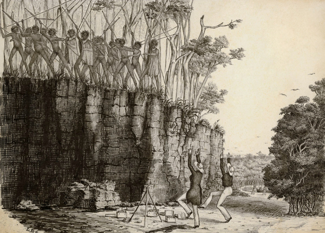
Fitzmaurice & Keys dance for their lives - the British Library
|
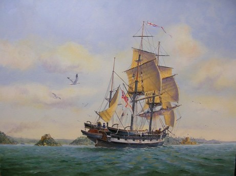
Painting by Ron Scobie of HMS Beagle heading up Sydney Harbour on 24th July 1838.
|
'Messrs. Fitzmaurice and Keys had firearms lying on the ground within reach of their hands; the instant, however, they ceased dancing, an attempted to touch them, a dozen spears were pointed at their breasts. Their lives hung upon a thread, and their escape must be regarded as truly wonderful, and only to be attributed to the happy readiness with which they adapted themselves to the perils of their situation. This was the last we saw of the natives in Adam Bay, and the meeting is likely to be long remembered by some, and not without pleasant recollections; for although, at the time, it was justly looked upon as a very serious affair, it afterwards proved a great source of mirth'.(John Lort Stokes, Discoveries in Australia)
The Adelaide River
''For thirty miles of the upper part of the river the water was fresh; while the banks, excepting near the point of separation, were low, being not more than five feet above the present level of the river, a circumstance very favourable for irrigation, and the cultivation of rice. Fifteen miles from the mouth they were fringed by the growth of mangroves; and higher up many of the points were thickly wooded, while on either side stretched a vast extent of prairie country, dotted here and there with islands of timber, which served to break the native monotony of the scene. Somewhat less than halfway up, rose on both banks a thick jungle of bamboo, which, in places where the water was always fresh, attained the gigantic height of from 60 to 80 feet. Between 20 and 70 miles from the mouth the soil is a good light-coloured mould; above this, commencing where the bank of the river is marked by a coarse red gritty sandstone projection, the aspect of the country changes from that of low plains to a slightly wooded and gently undulating surface, in some places stony. This character continued to the furthest point reached in the boats, in latitude 12 degrees 57 minutes South, and longitude 131 degrees 19 minutes East.
When they had penetrated thus far into the new lands of Australia, the explorers returned, having experienced sensations of delightful excitement, to which we have before alluded, and which naturally called forth strong emotions of regret in those who were denied a participation in the feverish enjoyment of discovery.
From the highest tree at Captain Wickham's furthest point, the appearance of the country was, as far as the eye could reach, one wearisome level, broken to the southward, at a distance of ten miles, by a rocky mound about 150 feet high.
'The river, which for some distance had not been fifty yards wide, with a rocky bed in places, and banks from six to twenty feet high, was subject at this point to a tidal change of level of about three feet, but there was no perceptible stream, and the water which a few miles lower down had been muddy, was here quite clear. Small bamboos and other drift were observed in the branches of the trees eight or ten feet above the water, showing the height which the river attains at some seasons of the year. By the hollows on many of the plains, water appeared to have lain some time, and doubtless parts of this low land were periodically overflowed.
On the point dividing the upper branches of the river some coarse sand was washed up, which on examination was found to be of a granitic character, clearly showing the primary formation of the country through which the Adelaide flowed. The only rocks noticed in the parts traversed by the boats were, as I have before said, of red porous sandstone. The smoke of several large fires was observed up the country, but no natives were seen.
On the point dividing the upper branches of the river some coarse sand was washed up, which on examination was found to be of a granitic character, clearly showing the primary formation of the country through which the Adelaide flowed. The only rocks noticed in the parts traversed by the boats were, as I have before said, of red porous sandstone. The smoke of several large fires was observed up the country, but no natives were seen.
MONKEY-BIRDS.
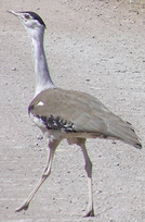
'Towards the upper part of the river they noticed a strange bird, very much like a guineafowl in size and manner of running along the ground. The colour was speckled white and brown. This, doubtless, from Mr. Bynoe's description of one he wounded on the coast in the neighbourhood of the Adelaide, must have been the Leipoa ocellata {Mallee Fowl} of Gould, one of the mound or tumuli-building birds, first seen in Western Australia by Mr. George Moore, and afterwards on the North-west coast, and in South Australia by Captain Grey.
Although known to range over a large expanse of the continent, this was the first time it was discovered in Northern Australia.'
{Not a Mallee Fowl as too far north – probably Australia’s heaviest flying bird, the Australian bustard or bush turkey - Ardeotis australis}
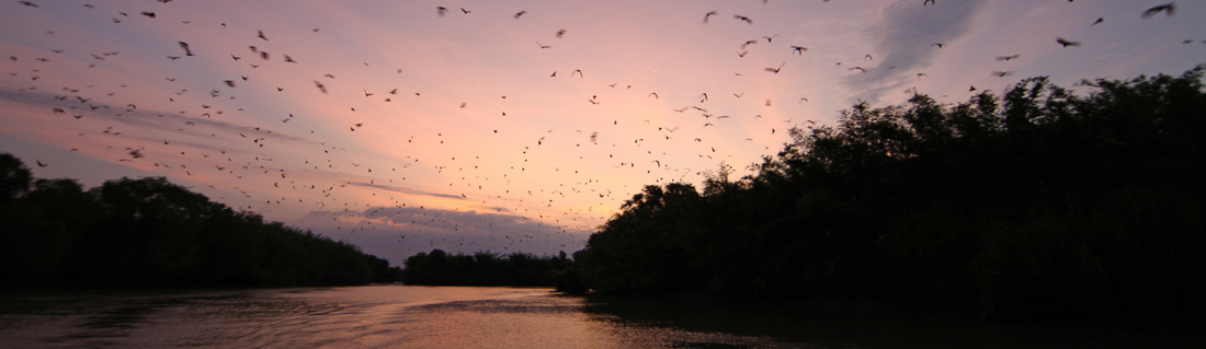
In the reaches where the bamboo grew, flights of large vampires (resembling the Pteropus rubricollis of Geoff.) were met with: they kept continually flying to and fro close over the boats as they passed up, making a screeching disagreeable noise, which, however, was far less unpleasant than the mildewy odour with which they filled the air, calling to mind the exclamation placed by our immortal bard in the mouth of Trinculo.
The heavy flap of the leathern wings of these monkey-birds, as the men called them, was singular, while sometimes a flight would darken the verdure of a bamboo, which, yielding to their weight, bent low, as if before a passing gust of wind. To fix themselves appeared always a difficult, and was certainly a noisy operation, each apparently striving to alight upon the same spot.
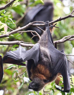
They first cling to the bamboo by means of the long claw, or hook attached to the outer edge of the wing, and then gradually settle themselves. {Pteropus Alecto - Black Fruit Bat or Flying Fox}
The heavy flap of the leathern wings of these monkey-birds, as the men called them, was singular, while sometimes a flight would darken the verdure of a bamboo, which, yielding to their weight, bent low, as if before a passing gust of wind. To fix themselves appeared always a difficult, and was certainly a noisy operation, each apparently striving to alight upon the same spot.
They first cling to the bamboo by means of the long claw, or hook attached to the outer edge of the wing, and then gradually settle themselves. {Pteropus Alecto - Black Fruit Bat or Flying Fox}
The river swarmed with alligators. Fish also abounded; and in the salt water, a kind commonly known in the river Plate by the name of Cat-fish, is plentiful. One that we caught was of the enormous weight of twenty pounds. A large kind of dark bream of excellent flavour was taken in fresh water'.
The Deepest River in Australia
' ... there was a 3-fathom channel at low-water, and in the reaches above, seven in number, trending in a general South-South-East direction, about twice that depth. This imparted to our discoveries the stamp of utility, and as Captain Wickham found it navigable for thirty miles higher up where the water is fresh, we may pronounce the Adelaide the deepest river in Australia.' (John Lort Stokes, Discoveries in Australia)
'This morning the boats returned; they had gone up the Adelaide in a general southerly direction, nearly 80 miles: the windings of the river, which were very great in some places, forming the shape of the letter S. It became at this distance very narrow, and was divided into two branches, one taking a southerly direction, the other an easterly; the latter was too narrow for the boat's oars, while the former was blocked up by fallen trees lying across it. As in addition to the difficulties just mentioned, only one day's provision remained in the boats, the further exploration of the Adelaide was necessarily, though reluctantly, abandoned.
Adam Bay
Hutchison and Howard carried out a survey of Adam Bay and Adelaide River in 1864 and showed Charles Point and Point Stephens on their chart of Adams Bay (British Admiralty Chart 1704).
Escape Cliffs
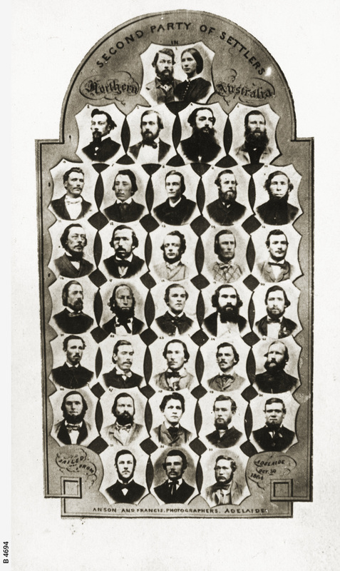 SLSA B-4694 - Anson & Francis 1864
On 21 June 1864 a small fleet of pioneers from Adelaide in the vessels Beatrice, Henry Ellis & Yatala arrived at Adam Bay which the newly appointed Government Resident Colonel Boyle Travers Finniss had courageously anointed as the site of the new northern settlement.
The 40 strong party is a roll call of Territory identities including the chief surveyor JT Manton - Frederick Litchfield, John Davis of the McKinlay Expedition - EJ Packard - S King & WP Auld of Stuart's successful expedition - W & G McMinn & E Ward the postmaster. The new settlement was proclaimed Palmerston to honour the Prime Minister of the United Kingdom - the name would subsequently be applied to the settlement at Fort Wellington, Port Darwin & finally its satellite city.
The paddle steamer South Australian arrived on 5th December 1864 with surveyors RH Edmunds & HD Packard - the first women Mrs Packard & Mrs Bauer along with the representative of the 200 land-order holders, Jefferson Stow who detested the place & Finniss on sight. Finniss visited Port Darwin which he rejected as "too landlocked" - the lack of a major river to bring trade goods from the interior was a major factor in Finniss' rationale. Ideally a settlement would be at the head of navigation where freshwater dominates the flow but this was not available in northern Australia. The necessity for steam tugs to lighters up the rivers demanded coal supplies or at least dry timber. The raison d'etre of a northern capital had changed from extending power to the trade routes through the Spice Islands up to China, as at Fort Dundas, and providing respite for sailing ships such as at Port Essington. Escape Cliffs was intended as a commercial port exploiting the untapped riches of the interior that lay in cattle, sheep and agriculture. The surveying and selling of land allotments to English investors was the pivotal factor of financial viability for the new settlement & port but also for the infant colony of South Australia which had been proclaimed on 28th December 1836 and had been granted its Northern Territory in 1863.
Finniss did visit Talc Head in Port Darwin for the purpose of quarrying 6 tons of quartz which was sent to Adelaide for assay aboard the Beatrice.
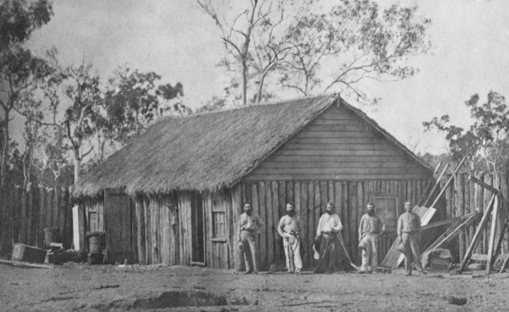
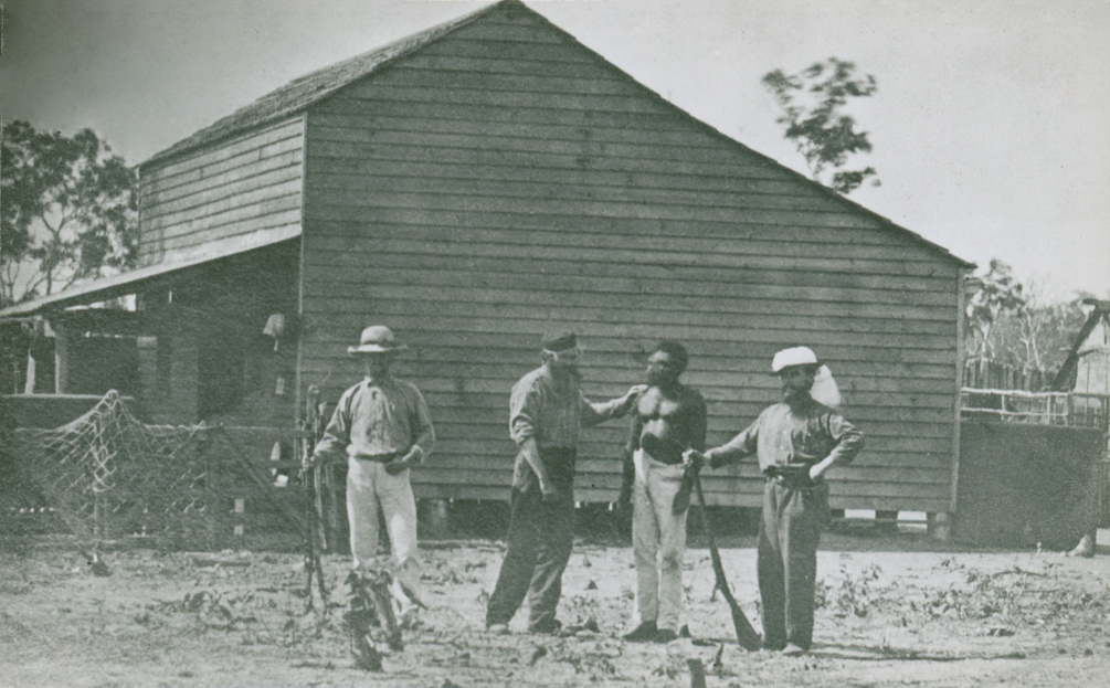
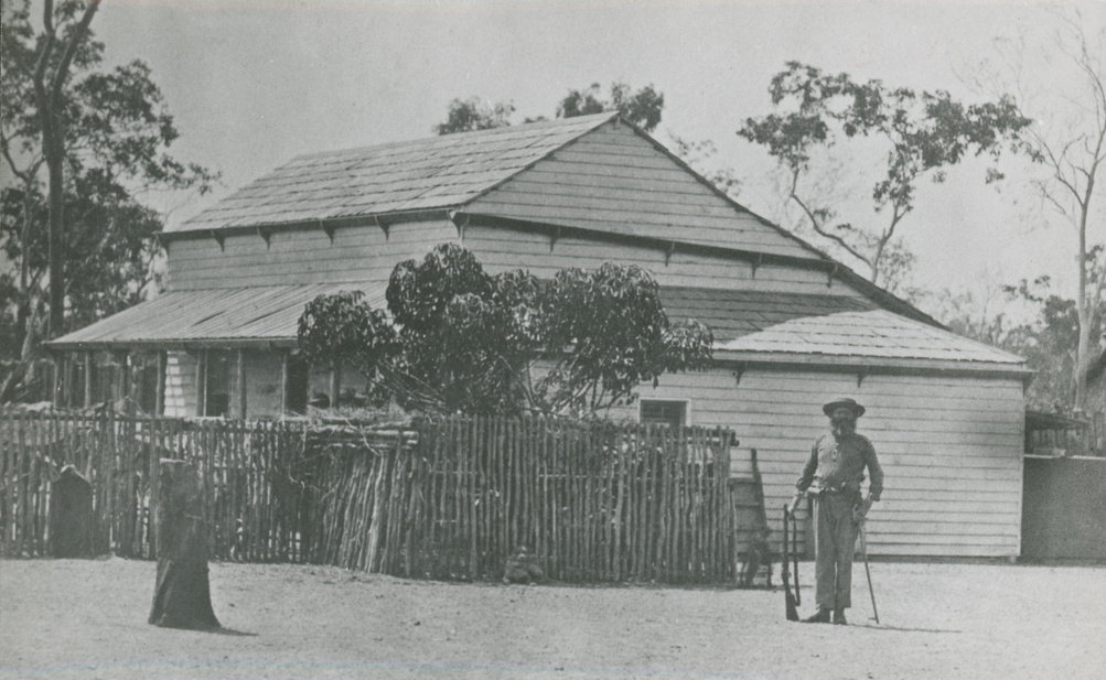
The First NT Photographs
SLSA B-7195 The man with a shotgun is Clement Young, clerk and accountant to the NT Survey in 1865-66
Amongst the members of the first expedition were two photographers A.R. Hamilton, Junior Surveyor & Charles Hake, labourer. They and their box of photographic apparatus would depart on 25th May 1865 aboard the Forlorn Hope on a 2,500 mile open boat journey which Hamilton had instigated. They would remain at Geraldton to start a photography business. The first image below is attributed to them in 1864 and shows the storehouse which was one of the first buildings erected. It has a crude grass thatch and is rough hewn local timber whilst the others are dressed boards and shingle roofs with windows. This may well be 1864 but in any event it is prior to the arrival of the Mermaid and Guy's image of the Horse Hide boat frame in 1866. The others are unattributed although from the similar & somewhat naïve compositions it seems likely that the others are also the work of Hamilton & Hake.

The 2500 mile 'Voyage of the Forlorn Hope'
'The new arrivals were nearly all Government officials, but three of them were private settlers seeking a fortune and experience. One was a German scientist, who was accompanied by his wife and child. He was mainly interested in meteorology. The other two free settlers were Mr Stuckey and Mr J. P. Stow, experienced South Australian colonists. A Government surveyor service also brought his wife and child with this party.' (The Forlorn Hope - A Saga of the Sixties by Frank Clune 1945 - all italicised)
To Mr Stow, seated in his tent, wistfully looking at the anchored Bengal, came a man with a proposition. The visitor was Arthur Hamilton, a fed-up young surveyor in the Government service. His proposal was that a whaleboat should be purchased from the skipper of the Bengal, and that a party should be made up, led by Mr Stow, to explore the coast westwards for 600 miles, as far as the settlement of Camden Harbour. “It’s rather a forlorn hope,” said Mr Stow, “but I’m willing to try it!”
Five other mangrove-sated colonists were invited to join the boat-party, and accepted the invitation with alacrity. Two of them were seamen, the other three employed in the Government Surveying Service. All were of good physique and stout-hearted. Going aboard the Bengal—still at anchor in the bay — Stow negotiated with the skipper, a simple-minded Swede, for the purchase of a boat. The skipper was not as simple-minded as he looked. His price was £60, take it or leave it—a staggering sum in those days of cheap labour and cheap commodities—but the buyers were at the seller’s mercy, so the deal was done. The boat, like the skipper, was made in Sweden. She was 23 feet in length, 6 feet across the beam, and 2 feet deep, with two masts and spritsails, and three pairs of oars. On May 4—two days before the Bengal sailed away— the purchase was completed and the boat brought ashore. Energetically, the seven men made ready for an early departure. They fitted washboards and some decking at bow and stern, also a jib-sail, and made lockers to hold provisions. Then they named her THE FORLORN HOPE. There was much head-shaking among the onlookers at this name of ill-omen, but the satirical seven were satisfied that the name was appropriate, so they kept it.
Five other mangrove-sated colonists were invited to join the boat-party, and accepted the invitation with alacrity. Two of them were seamen, the other three employed in the Government Surveying Service. All were of good physique and stout-hearted. Going aboard the Bengal—still at anchor in the bay — Stow negotiated with the skipper, a simple-minded Swede, for the purchase of a boat. The skipper was not as simple-minded as he looked. His price was £60, take it or leave it—a staggering sum in those days of cheap labour and cheap commodities—but the buyers were at the seller’s mercy, so the deal was done. The boat, like the skipper, was made in Sweden. She was 23 feet in length, 6 feet across the beam, and 2 feet deep, with two masts and spritsails, and three pairs of oars. On May 4—two days before the Bengal sailed away— the purchase was completed and the boat brought ashore. Energetically, the seven men made ready for an early departure. They fitted washboards and some decking at bow and stern, also a jib-sail, and made lockers to hold provisions. Then they named her THE FORLORN HOPE. There was much head-shaking among the onlookers at this name of ill-omen, but the satirical seven were satisfied that the name was appropriate, so they kept it.
'On May 6, 1865, after the Bengal’s departure, the Forlorn Hopers put their luggage and provisions aboard their little vessel. They had 200lb of biscuits, 120 lb of tinned beef, 70 gallons of water, and some firewood. The gear included a camp-oven and an iron bucket for cooking, also several shot-guns and ammunition, fishing lines and hooks, maps, charts, compasses and sextants, a small medicine-chest—and two bottles of beer. {Also a chest of photographic apparatus belonging to Messrs. Hamilton and Hake. JP Stow}Towards sundown of that same day, the whole population of Palmerston—except the Government Resident, ~, Boyle Finniss, and a couple of his senior officials— ~: assembled on the shore to bid the seven sturdy adventurers God-speed. They were leaving on the tide, which was nearly full. The Palmerstonians were also full, as they toasted the Forlorn Hope and her crew in beer which the Bengal had brought. After many cheers and beers, the sturdy seven went aboard. Their names were: J.P. Stow, j.r., leader of the party; Arthur Hamilton and William McMinn, surveyors and navigators; John White and James Davis, seamen; Charles Hake and Frank Edwards, surveyors’ chainmen. John Whiter who had been in the pilot service in Victoria and South Australia, was appointed Sailing Master and a good man he was, too, at handling a boat. All aboard, and renewed beery cheers came from the Palmerstonians on shore as the flag of the Forlorn Hope was raised to the masthead. It was a pennant with a strange device: FINIS CORONAT OPUS - translated freely by one wag as Finniss corroborees on the opposition.
They were headed for Camden Harbour a lonely outpost 230 miles NE of where Broome is today. After 23 days at sea, suffering storm and beaching on a reef 20 miles off Cape Bougainville they made the harbour.
The situation at Camden Harbour was worse, if anything, than that at Palmerston. The sheep are nearly all dead, the country worthless, and the whole settlement a failure. For five days the Forlorn-Hopers remained at Camden Harbour, listening to the colonists’ tales of woe. Instead of waiting for the relief-ship—which might not come for months—the Forlorn-Hopers decided to resume their open-boat voyage and to make for the next settlement, at Nicol Bay, some hundreds of miles further south. They obtained provisions sufficient for this journey and got a new anchor and rudder fitted. On June 3 they set sail, but did not clear Camden Harbour until 4 a.m. next day. Setting their course west-south-west, they stood out to sea. The land receded, and was soon out of sight. “Heigho for Nicol Bay!” sang the seven merry mariners—but then came a storm which blew them 200 miles out to sea, and they were all alone on the vasty deep of the Indian Ocean.
They endured nine sleepless days of gales during which they cut off the mainmast and let it float away. On 12th June the storm abated. Seventeen days after leaving Camden Harbour the made landfall but found no settlement. There was no settlement at Nicol Bay and they had sailed 50 miles past it in the night. Four days later they once again put to sea this time for Geraldton in Champion Bay, ‘a long and rugged journey down a dangerous coast’.
On 3rd July they landed on Dorre Island for a feast of snapper & shags – then headed down past Dirk Hartog Island - across Shark Bay and down to Champion Bay which they made on 8th July after some 2000 miles and sixty-three days from Escape Cliffs. Mistaken for shipwrecked mariners & escaped convicts, some fifty inhabitants helped drag them ashore and up to Barton’s Hotel on the beach for rum-toddys. Geraldton consisted of about 60 houses, nearly all built of stone, with two hotels, several churches, stores, a gaol and a jetty, a flagstaff, and a prosperous hinterland of farms, with a couple of copper mines whilst the back copies of the newspapers told of the assassination of President Lincoln and the marauding bushrangers Morgan, Ben Hall and Gilbert in N.S.W.
After a week in Geraldton, five of the voyagers sailed for Fremantle on a timber-barge with the Forlorn Hope as deck-cargo. The two photographers, Hamilton and Hake, remained in Geraldton and started a ‘fizzog-taking’ business. Five days later they made Fremantle, where they sold the Forlorn Hope to the skipper of a merchant vessel, who promptly capsized her in the harbour. They took the steamer to Perth then 255 miles by coach to Albany, where they boarded the steamer Rangatira, arriving at Port Adelaide on August 12th just over three months after escaping Escape Cliffs.
Their arrival at Adelaide caused a sensation, Finniss was duly recalled, being replaced as Resident by Manton. Escape Cliffs was abandoned and Palmerston shifted to Port Darwin where William McMinn's brother Gilbert, who was also at Escape Cliffs, would return in 1869 under Goyder as senior surveyor of the new city and acting Government Resident in 1883. A frenzy of Territory exploration ensued - recording many first with many hazardous journeys but none to equal the odyssey of the Forlorn Hope. It was a triumph of seamanship & endurance worthy of their pennant - FINIS CORONAT OPUS - The Knockout Ends the Fight. That the joke seems to have entirely escaped Frank Clune is in itself remarkable.
Their journey should rate amongst the great open-boat journeys of Bligh from Tahiti to Timor in 1789 - the Bryants from Sydney to Koepang in 1791 and Shackleton from Elephant Island to South Georgia in the James Caird after the loss of the Endurance in 1916. However, for sheer unbridled horror, it is the saga of the McKinlay party's survival at the hands of RH Edmunds in the Horse Hide Boat that eclipses all and alone amongst all other voyages will never be re-enacted .
Their journey should rate amongst the great open-boat journeys of Bligh from Tahiti to Timor in 1789 - the Bryants from Sydney to Koepang in 1791 and Shackleton from Elephant Island to South Georgia in the James Caird after the loss of the Endurance in 1916. However, for sheer unbridled horror, it is the saga of the McKinlay party's survival at the hands of RH Edmunds in the Horse Hide Boat that eclipses all and alone amongst all other voyages will never be re-enacted .
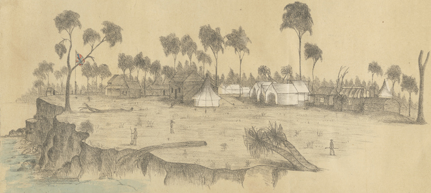
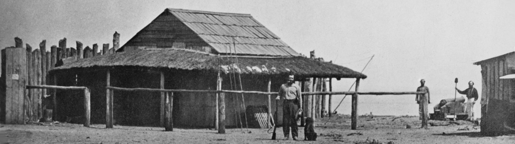
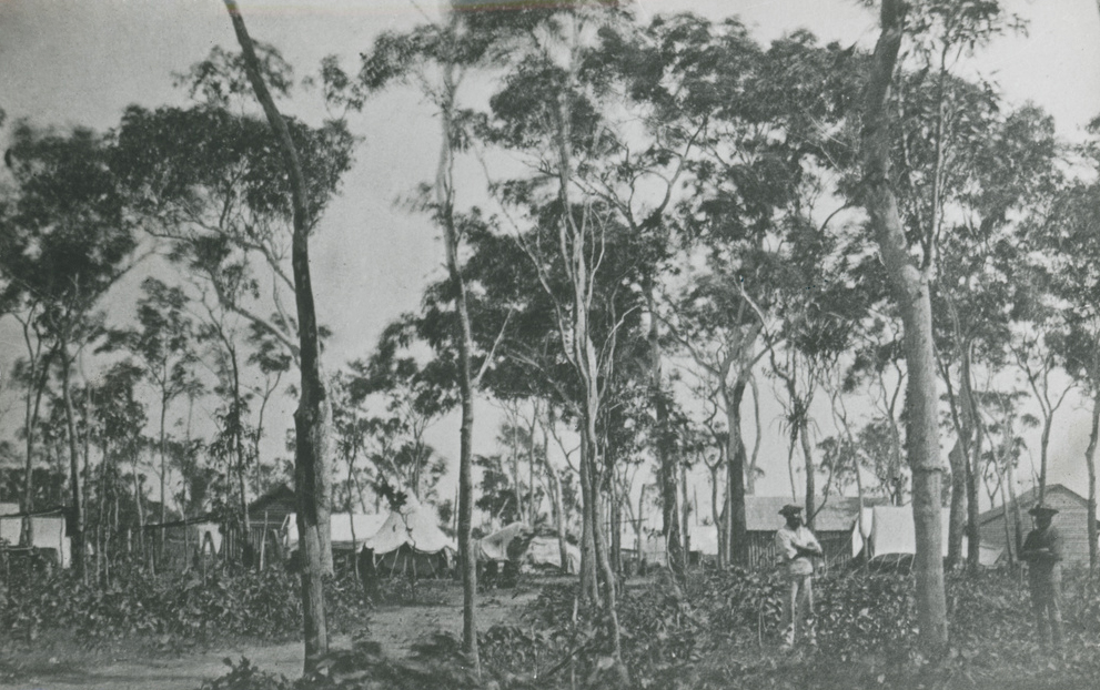
The City of Palmerston at Escape Cliffs
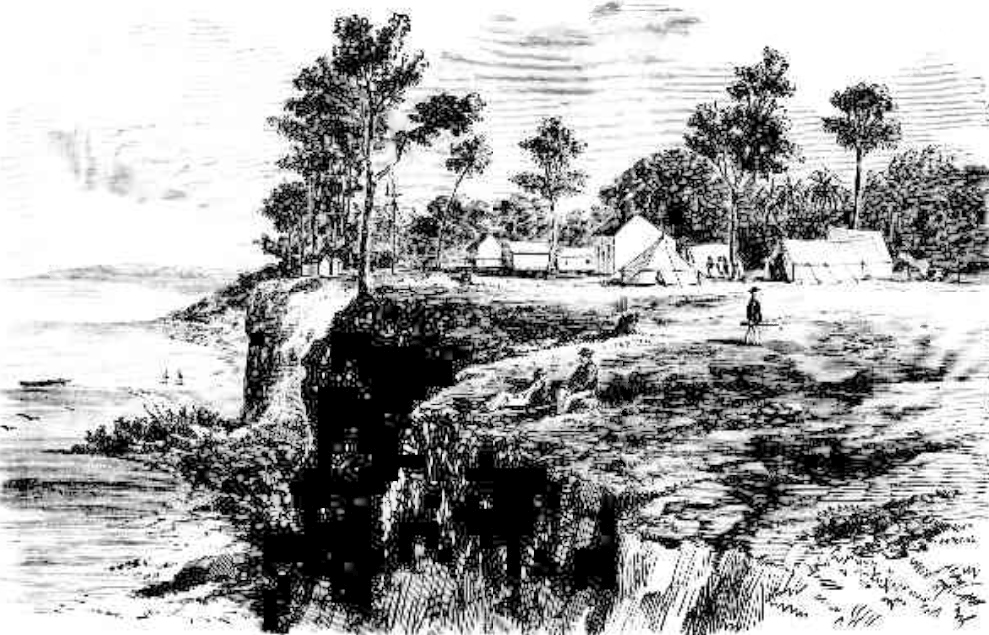 Encampment at Escape Cliffs, Palmerston 1866
We present our readers this month with a view; taken on the spot, of the site selected by Mr. Finnis for the capital of Northern Australia.
The sketch represents the government resident's quarters, and the tents of the expeditionary party at present located there, under the direction of Mr. John McKinlay, the well-known explorer, who relieved Mr. Finnis of his duties.
It would, perhaps, have been well had some other person than Mr. Finnis been chosen as the first commandant of the infant colony.
His administration has been marked by disorganisation, distrust, and inactivity.
Illustrated Sydney News Saturday 15 Sept. 1866
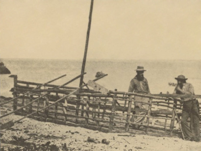
The Horse Hide Boat
In November 1865 Finniss was recalled and the explorer John McKinlay arrived at the head of a large party to search of an alternative site for Palmerston - McKinlay left Escape Cliffs for the West Arnhem Land coastal plains in mid-January 1866 - well into the Wet Season where 95% humidity, temperatures in the high thirties during the day & high twenties at night - breeding crocodiles - squadrons of flies & mosquitoes battling sandflies for landing space. After many weeks of torture they were at last nicely bogged on the mudflats & floodplains of the East Alligator River.
By May the receding waters would have allowed a reasonably comfortable overland return to Escape Cliffs but McKinlay insisted on a sea voyage. The horses were slaughtered and their hides stretched over a basket frame of sapling poles lashed with rawhide into a craft unfit for Jumblies. For 15 days and nights they braved crocodiles, sharks and a diet of putrefying horsemeat, across more than 100 miles of empty ocean - at last staggering ashore at Escape Cliffs emaciated and unrecognisable on the 5th July. The image below was taken by Michael Stewart Guy in 1866 - he was aboard the British survey schooner Beatrice - Beatrice Hill and research station are named for her.
By May the receding waters would have allowed a reasonably comfortable overland return to Escape Cliffs but McKinlay insisted on a sea voyage. The horses were slaughtered and their hides stretched over a basket frame of sapling poles lashed with rawhide into a craft unfit for Jumblies. For 15 days and nights they braved crocodiles, sharks and a diet of putrefying horsemeat, across more than 100 miles of empty ocean - at last staggering ashore at Escape Cliffs emaciated and unrecognisable on the 5th July. The image below was taken by Michael Stewart Guy in 1866 - he was aboard the British survey schooner Beatrice - Beatrice Hill and research station are named for her.
|
|
On 22 December 1866 the paddle-steamer Eagle under Captain Cadell who had pioneered their introduction on the Murray River - arrived at Escape Cliffs with orders to abandon the settlement. In February 1867 Cadell once again brought the Eagle to the north coast surveying for a site of 300,000 acres of good land. He navigated the Roper River for the first time and travelled extensively through the Wessels and English Company Islands - hence Cadell Straight between Elcho Island & the Napier Peninsular - Napier accompanied him. Cadell recommended a new settlement site at the mouth of the Liverpool River where Maningrida stands today.
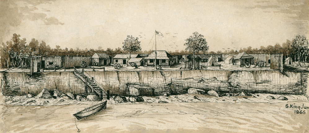
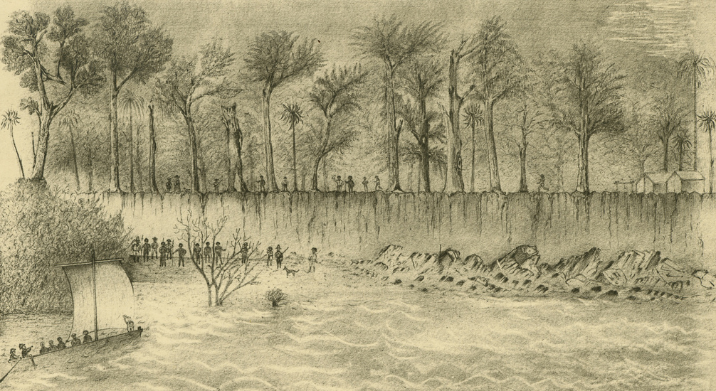
SLSA B-839 Pen and wash on paper sketch of the settlement of Escape Cliffs by Stephen King June 1865
Chinese Rice Growing 1880's
From the 1870s Chinese market gardeners successfully grew rice for local consumption. Although the early Chinese recognised that the flooded sub-coastal plains of the North were suited to rice production, no serious attempts to establish an industry were made until after World War II. (HC Forrester)
Dutch Rice Growing
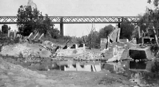
A Dutch engineer and agriculturalist Edwin Verburg had fields of waving rice and maize, all vegetables, all tropic fruit in the 1920's where the township of Adelaide River stands today.
With a few blacks to help him, Verburg constructed a grand little weir in the Adelaide River that cost him £3000. (Ernestine Hill The Territory).
The NTL image (http://hdl.handle.net/10070/27066) shows the "Broken dam, railway bride in background, Adelaide River, NT. The concrete remnants in the river are from Edwin Verburg's 1925 weir across the Adelaide River.
The photo is pre-WW2 as the Army further damaged the remnants when they constructed the Low level bridge that still exists".
The Humpty Doo Rice Project
Territory Rice Limited 1955-1964
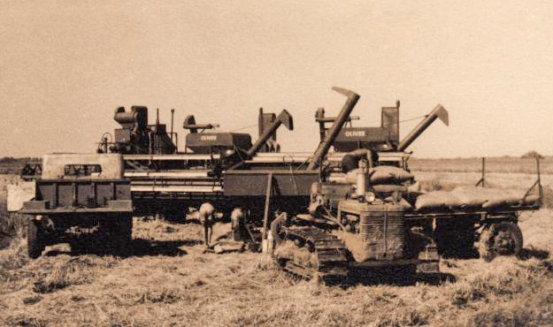
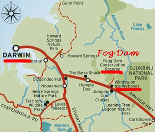
In 1953 Harold Holt, later Prime Minister of Australia, and American entrepreneur Allen Chase met at a party in Hollywood. The Australian government wanted to populate the north in the face of the rise of communism in SE Asia and rice production had been demonstrated. In late 1955 Chase raised a consortium of actors & Holt arranged for support from Australia's first merchant Bank, Mainguard to float Territory Rice Limited (TRL) on 303,000 hectares of sub-coastal plains from Humpty Doo Station the Adelaide River to Arnhem Land. The Royal Australian Airforce's Airfield Construction Squadron built Fogg Dam in 1956 under contract and Harrison Dam followed soon thereafter but was always troublesome - the Government put through a power line and other infrastructure but the project struggled from the start. In 1958 Mainguard was liquidated & in 1960 TRL collapsed under substantial debts. Four employees took on the project with some success but it finally folded in 1964. (http://www.ricetrail.com.au/ )
A common explanation for the failure of the rice project is that magpie geese ate the seed, there was also poor choice of site & rice species, poor crop planning & poor water management - critically compounded by poor finance and inept management. Fogg Dam is now a much visited wildlife sanctuary.
A common explanation for the failure of the rice project is that magpie geese ate the seed, there was also poor choice of site & rice species, poor crop planning & poor water management - critically compounded by poor finance and inept management. Fogg Dam is now a much visited wildlife sanctuary.
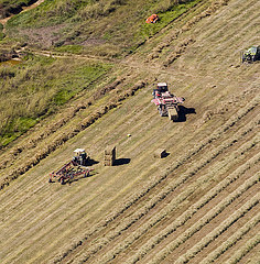
Tortilla Flats Research Farm 1958-1990
During WWII the area SE of Coomalie Creek airfield at Tortilla Flats was an artillery and aerial weapons range.
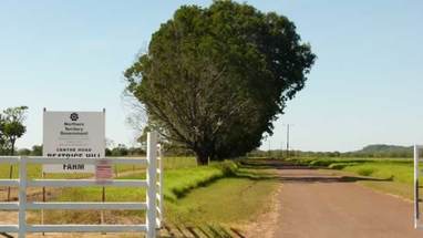
In 1958 three farms were set up on the Marrakai Land System adjacent to the Government's Upper Adelaide River Experiment Station (renamed Tortilla Flats Research Farm). One was to be a rice farm, the 2nd for rice growing with cattle fattening and the 3rd would have conducted a cattle breeding and fattening operation on improved pastures.
After 2 seasons, rice production was abandoned, the rice farm shut down and the 2 others turned to cattle breeding. It is not the purpose of this forum to hold a post-mortem on the pilot farms.
Nevertheless, I should like to point out that the results of the scheme were inconclusive; in other words they did not prove or disprove anything.‘
J. MAILATH 25th March 1981
Djukbinj National Park
‘Djukbinj’ refers to the King Brown snake dreaming and is a name given to the National Park by the Limilngan-Wulna Aboriginal people who own the land on which the park is situated.
The Park is divided in two sectors, Cape Hotham and Marrakai which are separated by 25 kilometres of pastoral land.
The Marrakai sector is located about an hour's drive from Darwin adjacent to the Arnhem Highway (60km south-east of Darwin) and is dry season access only.
The Cape Hotham sector adjoins the coast between Adam and Chambers’ Bays and is 50km north-east of Darwin and is only accessible by boat.
http://www.parksandwildlife.nt.gov.au/__data/assets/pdf_file/0005/353966/Djukbinj_NP.pdf
Melacca Swamp Conservation Area
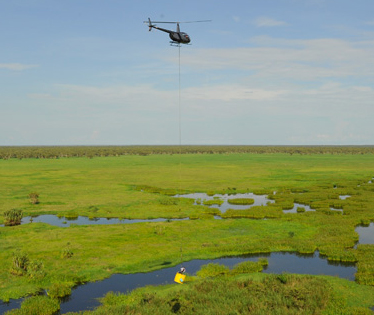
This site extends from near the junction of the Margaret River in the south, downstream to the mouth of the river. It includes the mangrove swamp in the Wilshire Creek area and the east limit is the narrow connection with the Mary River floodplain on the eastern side of Lake Finniss.
Floodplain wetlands within the site include Lake Finniss, Melacca and Black Jungle Swamps, the artificial Fogg and Harrison Dams, and various billabongs and lagoons.
The site encompasses an area of 1770 km² and comprises almost 975 km² of seasonally inundated coastal floodplain and 164 km² of tidal flats in the north, excluding the adjoining tidal flats in Chambers Bay.
The site abuts Chambers Bay, to the north, the Mary River coastal floodplain, to the east, and the Howard sand sheets, to the west. These are also recognized as sites of high conservation significance in the NT. http://www.lrm.nt.gov.au/__data/assets/pdf_file/0005/13928/12_adelaide.pdf
Beatrice Hills Farm
Located at Middle Point near the Adelaide River on the Arnhem highway, BHF is Australia's only buffalo research facility - comprising c 2600 hectares of black soil flood plains on the Adelaide River.
The principal objectives are to develop buffalo production systems and sustainable flood plain utilisation by cattle and buffalo. It is the only Buffalo Research program in Australia. We provide buffalo and production advice to interstate buffalo producers. We represent Australia, and contribute buffalo production information, to international buffalo congresses.
BHF is the most significant site for Arbo virus monitoring and testing in North Australia. The project is part of the nationally funded program.
There are significant buffalo herds in Arnhem land & opportunities to develop indigenous buffalo enterprises similar to the Gulin Gulin Buffalo Company at Bulman.